Available for new opportunities

Yulia Nugroho

GIS Engineer at UC Berkeley building campus-scale digital twins, fusing LiDAR, photogrammetry, real-time sensor data, and game engine visualization into intelligent geospatial environments.

10+
Yrs Experience
4
Organizations
2
Countries
20+
Tools Mastered
Digital Twin Visualization
UC Berkeley Campus Digital Twin
LiDAR Point Cloud
ArcGIS + Unreal Engine
Real-time Sensing

Where Engineering
Meets Imagination

I'm a GIS Engineer and Digital Twin Developer with over a decade of experience bridging the physical and digital worlds. Currently at UC Berkeley, I build interactive 3D environments that transform raw geospatial data into living, breathing infrastructure simulations.

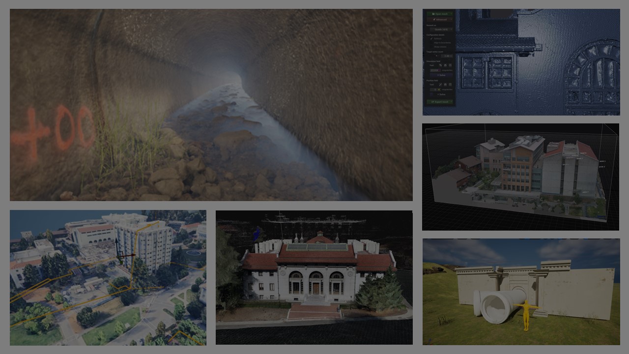
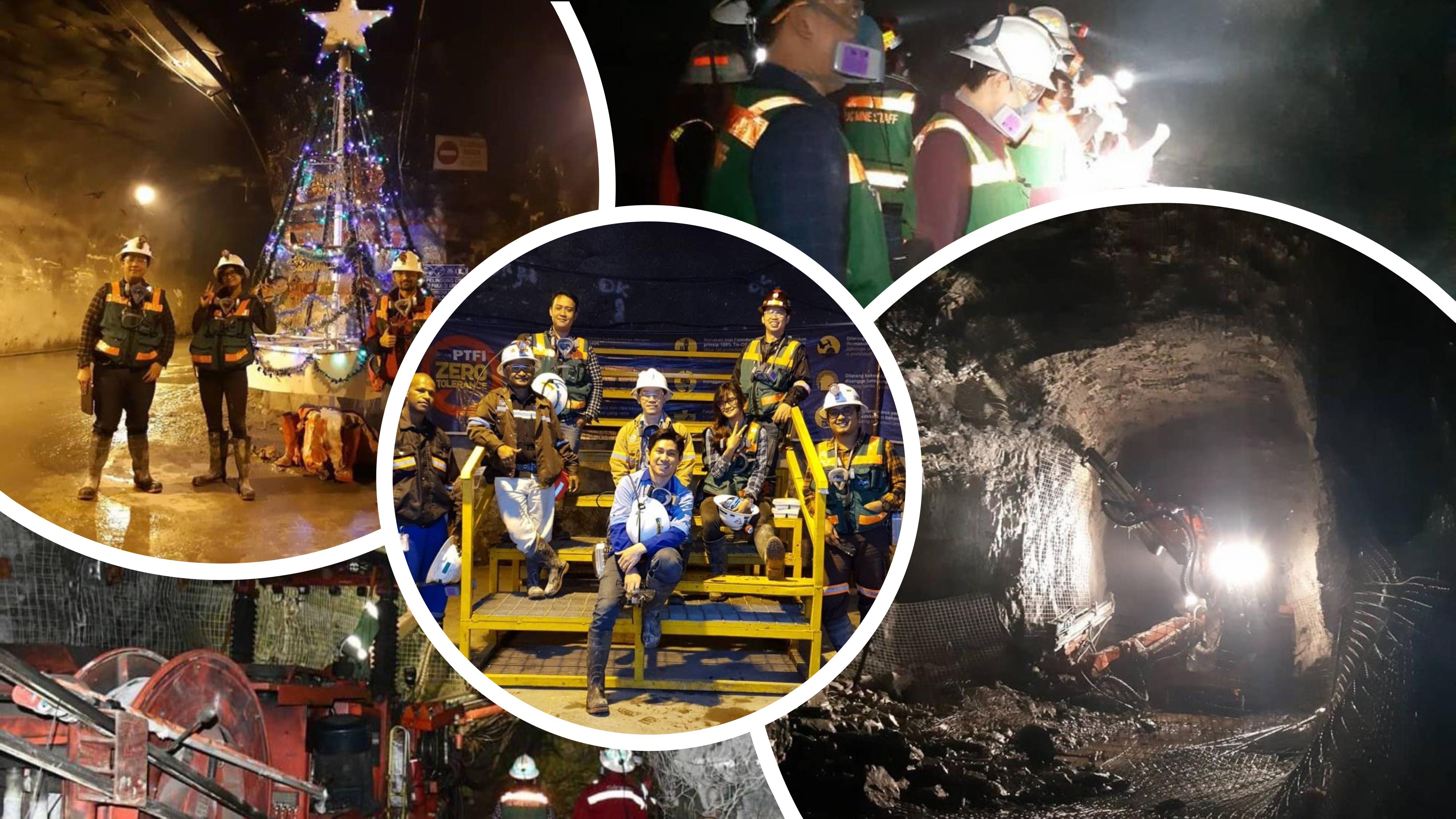
My career spans Indonesia and the United States — from mapping subsurface geology at Freeport McMoRan's underground mines in Papua, to prototyping next-generation 3D workflows at Esri in California, and now integrating LiDAR, photogrammetry, and real-time sensor data into campus-scale digital twins at UC Berkeley.

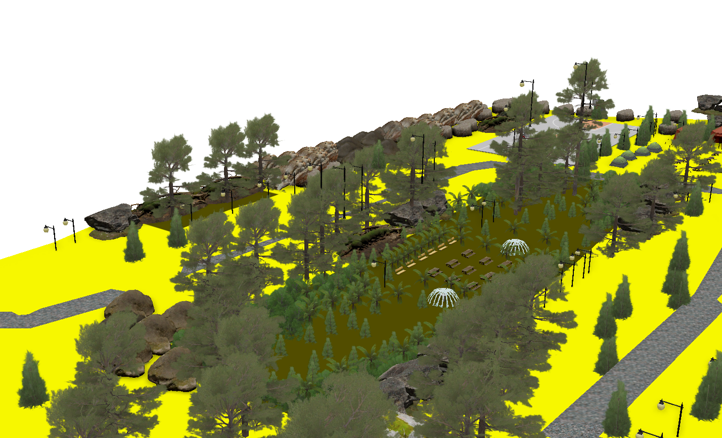
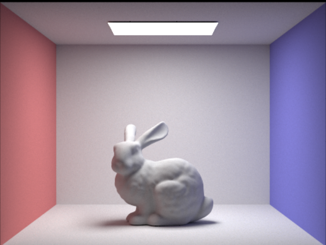
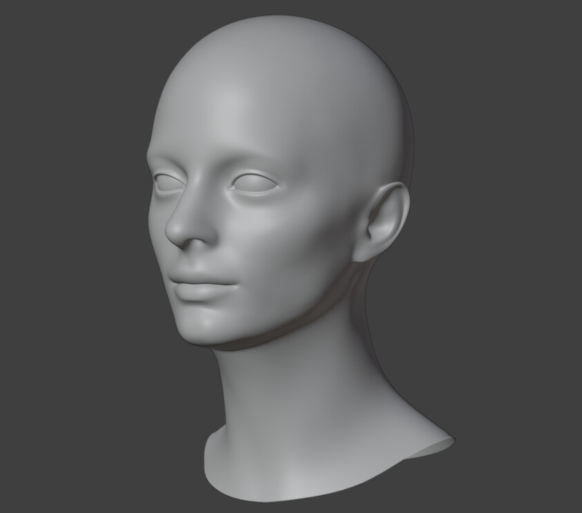
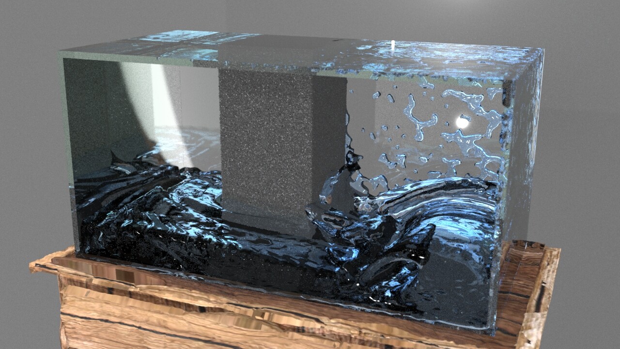
I'm equally passionate about the creative side of technology — from building game engine visualizations in Unreal Engine to implementing computer graphics algorithms from scratch in C++.

3D Geospatial Analysis · LiDAR · Photogrammetry · InSAR
Digital Twin Development · Unreal Engine · Blender
Smart Infrastructure · Real-time Sensing · ArcGIS Pro
Computer Graphics · Game Development · 3D Character Art

UC Berkeley

MS Geosystem Engineering — focused on geospatial data acquisition, digital twin development, and computational infrastructure modeling.

Field Engineering Background

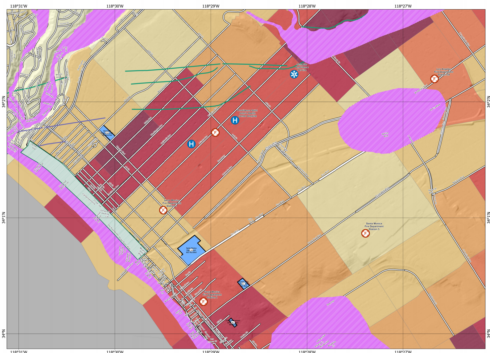
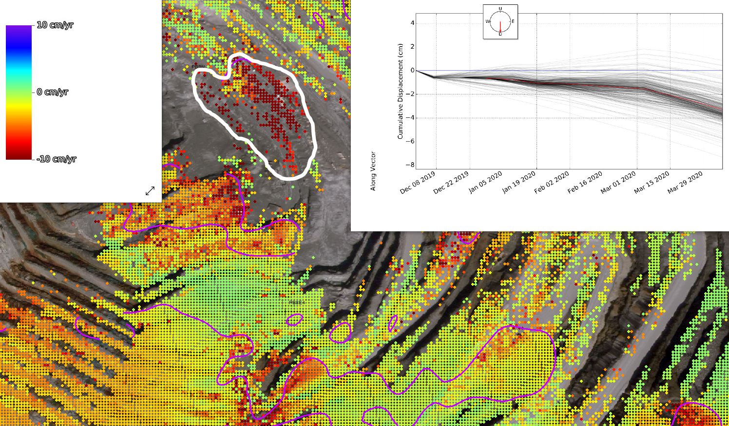
5+ years at Freeport McMoRan managing geotechnical monitoring for underground mines, developing subsidence models protecting 650+ facilities.

Remote Sensing Expert

Hands-on experience with InSAR, LiDAR, IBIS radar, GPS prisms, photogrammetry, and satellite imagery analysis (Landsat, NAIP).

Creative Technologist

Passionate about combining engineering rigor with creative design — from Esri QA testing to implementing custom path tracers and building stylized game art.

Professional Experience

A decade of engineering across mining, geospatial technology, product development, and cutting-edge digital twin research.

UC Berkeley
GIS Engineer
Sep 2025 – Present
Berkeley, California
  • Develop campus-scale 3D infrastructure and digital twin environments integrating LiDAR, photogrammetry, utility networks, and distributed sensing using ArcGIS, Unreal Engine, and Blender.
  • Perform 3D spatial analysis, feature extraction, surface modeling, and satellite-based remote sensing analysis (Landsat, NAIP, vegetation indices, burn-severity mapping).
  • Integrate real-time data streams from water, sewer, energy, and fiber-optic sensing into geospatial 3D models for infrastructure monitoring.
  • Coordinate with UC Berkeley Facilities, EBMUD, and PG&E to support system assessment, resilience analysis, and operational awareness.
ArcGIS Pro Unreal Engine Blender LiDAR Digital Twin Photogrammetry Real-time Sensing
Esri
Product Engineer Intern
Jun – Aug 2025
Redlands, California
  • Conducted daily QA testing of 3D features in ArcGIS Pro, including Multipatch editing and 3D Object Feature Layers.
  • Developed workflows for applying PBR textures to user-generated 3D models, improving visual realism in ArcGIS Pro 3.6.
  • Prototyped and evaluated 3D editing and visualization workflows to improve usability and performance of ArcGIS Pro 3D features.
ArcGIS Pro 3.6 3D Object Layers PBR Textures QA Testing Multipatch
Freeport McMoRan
Geotechnical Engineer
Feb 2018 – Jun 2023
Tembagapura, Indonesia
  • Developed 3D subsurface interpretation and modeling for underground mines using Map3D, Voxler, Maptek Vulcan, Leapfrog, and Deswik CAD.
  • Monitored surface deformation and underground mine failures using IBIS radar, LiDAR, InSAR, prisms, GPS, photogrammetry, and TDR instruments.
  • Modeled subsurface deformation and mining-induced subsidence across six major mines, safeguarding 650 stakeholder-owned facilities.
  • Led the Subsidence & Transition team as a founding member — established workflows, coordinated with consultants, internal departments, and external stakeholders.
  • Performed rock mass quality assessment, slope stability analysis, and geological mapping in block cave and stope mining operations.
Map3D Leapfrog InSAR IBIS Radar Maptek Vulcan Slope Stability Subsidence Modeling
LAPI – Bandung Institute of Technology
Petroleum Geologist
Jul 2015 – Jun 2017
Bandung, Indonesia
  • Analyzed petrophysical parameters for optimal reservoir testing intervals for potential sites in the South Sumatera Basin.
  • Examined core samples to increase the accuracy of petrophysical parameter interpretation.
Petrophysics Reservoir Modeling Core Analysis
TotalEnergies
Petroleum Geologist Intern
Feb 2015 – May 2015
Balikpapan, Indonesia
  • Designed a new oil and gas well for a field located in Kalimantan, Indonesia.
  • Built a 3D geology model of the reservoir to estimate the quantity of oil and gas resources using PETREL.
  • Increased access to oil and gas reserves within the deep reservoir zone by 500 mbbl in Kutai Basin, Indonesia.
PETREL 3D Geological Modeling Well Design Reservoir Estimation

Featured Projects

From underground mine monitoring to campus digital twins and physically-based rendering — a diverse body of technical and creative work.

Campus Digital Twin
View Project
Digital Twin
UC Berkeley Campus Digital Twin
Campus-scale 3D digital twin integrating LiDAR, photogrammetry, utility infrastructure, and real-time sensor streams for smart campus management.
Unreal Engine ArcGIS Pro Blender LiDAR Real-time IoT
GIS Analysis
View Project
GIS & Remote Sensing
3D Geospatial Analysis & Mapping
Advanced ArcGIS Pro workflows for 3D scene building, campus pipeline mapping, LiDAR processing, and satellite-based burn severity mapping.
ArcGIS Pro LiDAR Landsat NAIP
Park 3D Design
View Project
GIS & 3D Modeling
3D Park Design — Los Angeles
Conceptual 3D urban park design in LA using ArcGIS Pro, incorporating solar irradiance analysis, accessibility routing, and full scene visualization.
ArcGIS Pro 3D Modeling Solar Analysis Urban Design
Underground Mining
View Project
Geotechnical Engineering
Underground Mine Geotechnical Monitoring
3D subsurface modeling, deformation monitoring, and subsidence analysis across six major mines at Freeport McMoRan's Grasberg complex in Papua, Indonesia.
Map3D Leapfrog Subsidence Rock Mechanics
InSAR Monitoring
View Project
Remote Sensing · Geotechnical
InSAR & Satellite Deformation Monitoring
Developed crack-line and deformation analysis workflows using satellite InSAR, IBIS radar, GPS, and LiDAR for mine stability assessment.
InSAR ArcGIS IBIS Radar LiDAR
Computer Graphics
View Project
Computer Graphics
Rendering Engine & Physics Simulation
Implemented from scratch: rasterization pipeline, physically-based path tracer with global illumination, and position-based cloth simulation — all in C++.
C++ Path Tracing GLSL Physics Sim
3D Character Art
View Project
3D Art & Game Development
3D Character & Environment Art
Stylized 3D character models, rigged assets, environment design, and fluid simulation for game development. Fully detailed with texturing and lighting.
Blender 3D Modeling Character Design Game Art
Game Project
View Project
Game Development
Real-time Fluid Simulation & Game
Final game project featuring a custom MPM (Material Point Method) fluid simulation, real-time particle rendering, and interactive gameplay mechanics.
C++ MPM Simulation OpenGL Game Engine

Technical Skills

A broad and deep toolkit built across geospatial engineering, 3D visualization, programming, and creative design.

GIS & Geospatial

ArcGIS Pro ArcMap ArcGIS Reality Studio Drone2Map Google Earth Engine ArcGIS Data Interoperability EPAnet Cloud Compare Agisoft Metashape

3D & Visualization

Unreal Engine Blender AutoCAD 3D Revit Houdini Unity Bentley Products Deswik CAD

Remote Sensing & Monitoring

LiDAR Processing InSAR Analysis Photogrammetry IBIS Radar Landsat / NAIP TDR Instruments GPS Prism Arrays Canary System

Geotechnical Engineering

Map3D Voxler Leapfrog Maptek Vulcan Rocscience Suite Plaxis 2D Minesight Dips / SlopeW

Programming & Tools

Python C++ Visual Studio / VS Code GitHub Desktop Google Earth Engine Houdini Reality Capture

Languages & Domain Skills

English (Fluent) Indonesian (Native) Japanese (N5) Subsidence Modeling Slope Stability Reservoir Modeling (PETREL) VR Simulation Smart Infrastructure

Education & Training

A foundation in geological engineering expanded to cutting-edge geospatial technology and digital twin development at UC Berkeley.

Master of Science — Geosystem Engineering
University of California, Berkeley
📍 Berkeley, CA  |  🎓 May 2025
Advisor: Prof. Kenichi Soga. Developed a campus digital twin using ArcGIS Pro, Blender, and Unreal Engine; performed UAV/LiDAR scanning and photogrammetry; integrated real-time data for pipeline leak detection (EPAnet) and created VR tunnel simulations for civil engineering training. Coursework: Engineering Geology, Advanced Geomechanics, Smart Infrastructure, Remote Sensing.
Bachelor of Science — Geological Engineering
Bandung Institute of Technology (ITB)
📍 Bandung, Indonesia  |  🎓 Oct 2015
Thesis: "Geology and Static Reservoir Modeling in Q Field Lower-Deep Zone, Kutai Basin, East Kalimantan." Core studies in structural geology, rock mechanics, petrophysics, and geotechnical engineering.

Get In Touch

I'm actively looking for new opportunities in GIS engineering, digital twin development, smart infrastructure, and geospatial technology. Whether you have a role to discuss or a project idea — I'd love to hear from you.

Send a Message

Fill out this form and I'll get back to you as soon as possible.

✓ Thanks! Your message has been sent. I'll be in touch soon.